 vesseltracker.com
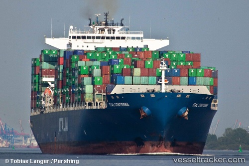
Vessel CONTI CONTESSA IMO: 9293806, MMSI: 256011000 Container Ship
UTC, 47.08570, -169.95563, course: 101, speed: 17.7
UTC, 47.02901, -169.35611, course: 100, speed: 18
2026-02-08 11:23:59 UTC, 46.95500, -168.57832, course: -1, speed: 18
Live AIS position:
UTC. 266 nm W of Achau),
updated 2026-02-08 11:23:59 UTC.
Find the position of the vessel CONTI CONTESSA on the map. The latter are known coordinates and path.
marine traffic ship tracker show on live map
The current position of vessel CONTI CONTESSA is 46.95500 lat / -168.57832 lng. Updated: 2026-02-08 11:23:59 UTCCurrently sailing under the flag of Malta
CONTI CONTESSA built in 2006 year
Deadweight:
107055 tDetails:
Last coordinates of the vessel:
UTC, 47.17333, -170.95667, course: -1, speed: 18UTC, 47.08570, -169.95563, course: 101, speed: 17.7
UTC, 47.02901, -169.35611, course: 100, speed: 18
2026-02-08 11:23:59 UTC, 46.95500, -168.57832, course: -1, speed: 18